WELCOME TO THE ULU KALUMPANG - WULLERSDORF SFM PROJECT WEBSITE
Introduction
Ulu Kalumpang Forest Reserve is a refuge for the endangered iconic animals of Borneo and serves to protect the headwaters and water catchment areas that are a source of water for the inhabitants of the Tawau Peninsula. The reserve is 35km from bustling Tawau, Sabah’s third largest town. Ulu Kalumpang was first announced as a forest reserve in 1956 as a block of land about 862 square km. From 1959-1979 the land was de-reserved by 335 square km. It was reclassified as a Class Two Forest Reserve in 1984, and eventually in 1992 it progressed into a Class One Forest Reserve with a final area of 511 square km. Ulu Kalumpang is linked to other forest reserves - in the south it links with Tawau Hills Park and Mount Wullersdorf Forest Reserve as well as linking to the Ulu Segama Forest Reserve. These reserves have been linked in the hope of reuniting wildlife that have become isolated due to human activity and to provide sound management for securing wildlife long term survival. Ulu Kalumpang is in an area called the Tawau Highlands and is very mountainous. It is covered in five main forest types, 70% of which are lowland mixed dipterocarp forest, the rest is made up of upland mixed dipterocarp forest, lowland mixed & kerangas forest and a small portion consists of lower montane forest. There are several rivers running through the reserve, the main one is Kalumpang River; its tributaries being the Mantri and Malati Rivers. Others include Binuang River which flows into Tingkayu and finally the Merutai Kanan which flows southwards from the reserve.
The Ulu Kalumpang-Wullersdorf Sustainable Forest Management (SFM) Project is one of the Sabah State Government’s projects under the Ninth (2006-2010),tenth (2011-2015) and now eleventh Malaysia Plan (2016-2020) which covers an area of 64,953.74 hectares. The State Government has given a total input of 8 Million Ringgit Malaysia to be utilised under this project. This Project was launched on 15 Mac 2006 and is totally managed under the Sabah Forestry Department. The Ulu Kalumpang Forest Reserve which covers an area of 50,736 hectares is the biggest forest reserve under this project and falls within Class 1 Forest Reserve (Protection). The other reserves are Kalumpang VJR107C covering an area of 950 hectares, Kalumpang VJR107 of 1,950 hectares and Kalumpang VJR107E of 868 hectares. All these three reserves are classified as Class 6 (Virgin Jungle Reserve). Ulu Kalumpang Forest Reserve is a water catchment for the Tawau region. These reserves have been degraded due to intensive encroachment activities since the 1980s with agricultural crops such as cocoa and oil palm. As assessed, the encroachment area is mainly in Ulu Kalumpang Forest Reserve covering a gross area of 8,980 hectares. Under the Ninth Malaysia Plan, the SFM activities were concentrated only in Ulu Kalumpang Forest Reserve. Sabah Forestry Department throughout its operations would adhere to the basic criteria of sound forest management, by ensuring that the forest activities in Ulu Kalumpang Forest Reserve will be environmentally appropriate, socially beneficial and economically viable.
Annexation of Mt. Wullersdorf Forest Reserve and Madai Baturong Forest Reserve to FMU Ulu Kalumpang
Mt. Wullersdorf FR which is 8,137 hectares, was formally under Tawau Forestry District. Some parts of this reserve, especially in the eastern part is covered by various land titles, which are still under investigation. There are some illegal encroachments in the western and southern portions of the reserve. This FR is adjoining to Ulu Kalumpang FR. SFM practices are needed to secure the safety of the reserve and to rehabilitate the encroached areas. On 1st April 2009, the Director decided to include this FR under Ulu Kalumpang-Wullersdorf SFM project. Again, in 2012, Madai Baturong FR(Binuang) was added as part of the project area.
These smaller FRs were annexed to FMU Ulu Kalumpang to form a larger FMU Ulu Kalumpang-Mt Wullersdorf, and to be administered by the DFO Kunak. The main reason for this annexation is to protect biodiversity and wildlife corridor connectivity. In 2012, a total area of 978 ha were excised from the project area for the purpose of socio-economic development, i.e. 228 ha from Ulu Kalumpang, and 720 ha from Mt. Wullersdorf.
The total area of this project now stands at 64,953.74 Ha, which includes four (04) VJRs;V12 (i) Kalumpang VJR107C (950 ha), (ii) Kalumpang VJR107D (1,950 ha) and (iii) Kalumpang VJR107E (868 ha) (iv) Madai Baturong VJR107F (2,312.74ha). The new title of this project is “Ulu_Kalumpang-Wullersdorf SFM Project”.
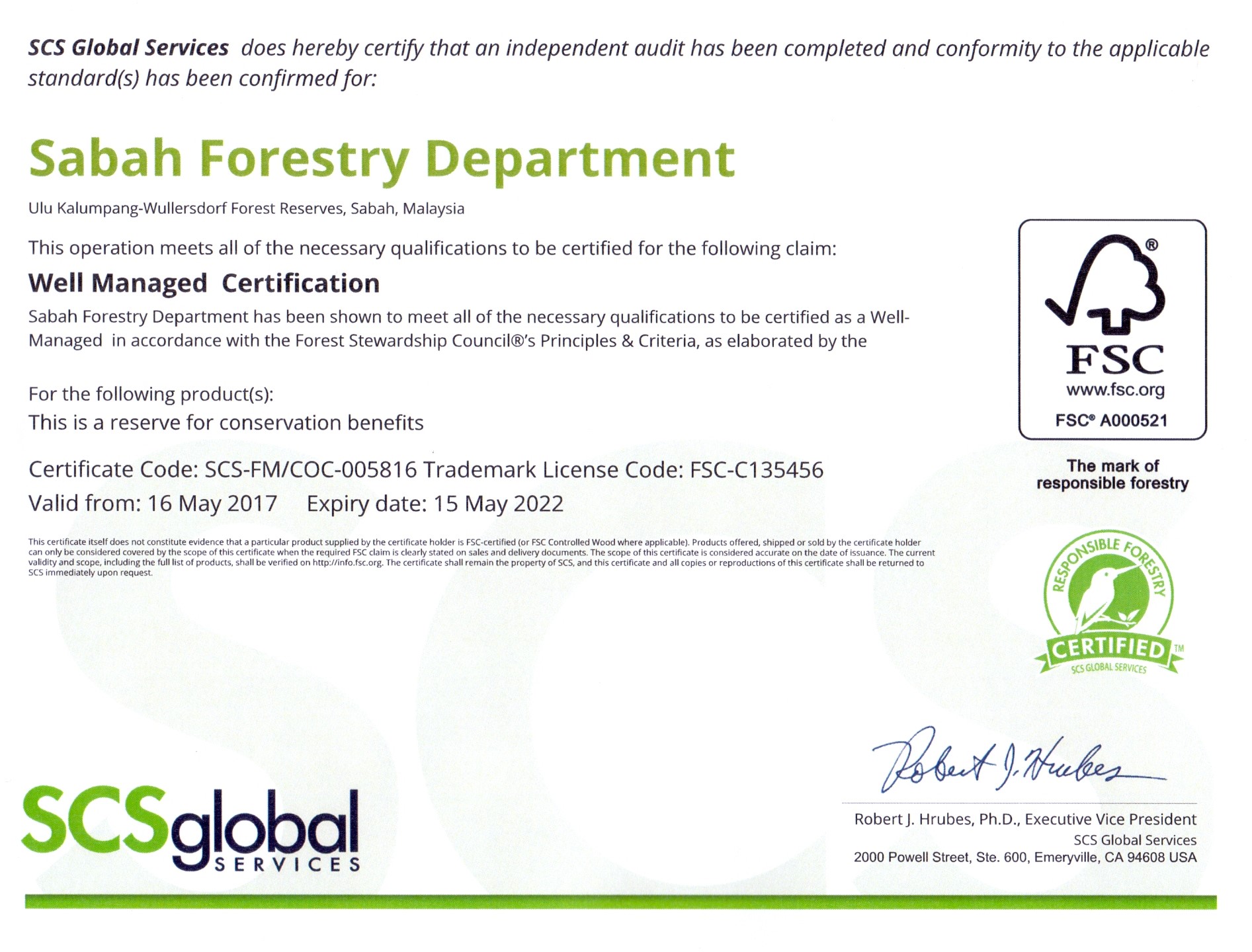
Ulu Kalumpang-Wullersdorf Sustainable Forest Management (UKW- SFM) project has successfully obtained their FSC certification for the period of five (5) years (16thMay 2017- 15th May 2022).
![]() Location map of Ulu Kalumpang-Wullersdorf SFM Project Area
Location map of Ulu Kalumpang-Wullersdorf SFM Project Area
![]() Compartment map of Ulu Kalumpang-Wullersdorf SFM
Compartment map of Ulu Kalumpang-Wullersdorf SFM
Website last updated on : 22 Oct 2021